For the pipe GIS data to be converted to a model, the model database must still be open, i.e. the Wa_pipe, Wa_pump, etc. layers must be displayed in the GIS Layer Manager.
Then, select Manage Models > Merge into Model > Import from GIS. The following dialog box will appear:
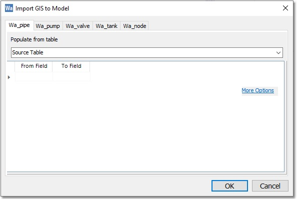
For this example, the GIS import applies only to the Pipe/CV table of the model (i.e. Wa_pipe). Select from the Populate from table drop-down list the GIS layer labelled My_SYSTEM_EXISTING as the data source, and in the From Field / To Field settings, select the import of the diameter information (matching field names will be listed automatically, as will be the case in this example).
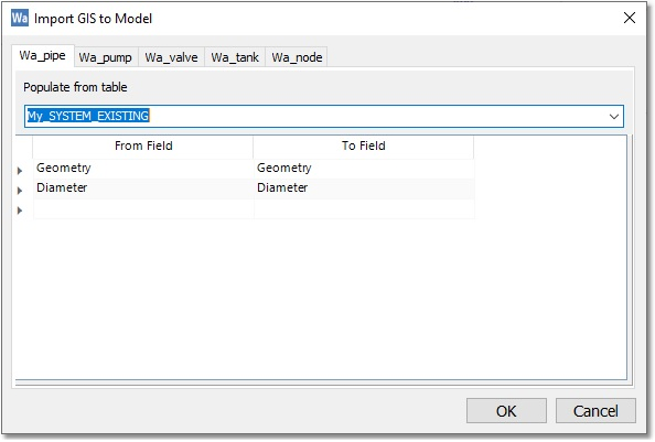
When all the required fields (only Diameter for this example) have been mapped, select OK.
The end result is a Wadiso model with 17 Pipes and 14 Nodes. The pipes have been assigned their correct diameters. Pipes and Nodes have been assigned numbered Code ID’s, based on the current numbering scheme in the model settings.