GIS > Data > Create/Merge Layer from CAD (select from Main Menu)
![]() Create/Merge Layer from CAD (select from drop-down menu on GIS Layer Manager Bar)
Create/Merge Layer from CAD (select from drop-down menu on GIS Layer Manager Bar)
Create/Merge layer from CAD.
Choose which CAD layers you will be importing, and specify whether to import those objects into a new GIS layer, or into an existing GIS layer (i.e. either type in a new layer name in the Destination GIS layer drop-down box, or select from it the existing GIS layer).
There are several parameters that control what types of CAD objects will be imported. For example, you may wish to bring circles in as point objects. In such a case, the circle center will be used to determine the point location. When importing for example polylines from CAD, you can specify to import them as polygon or polyline features, and whether only closed polylines/polygons should be imported.
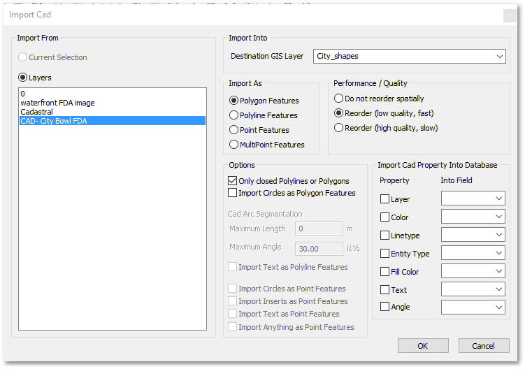
During CAD import, you may also bring over a few of the CAD objects' properties into GIS fields of your choice. This can be useful, for example, if you are importing a number of CAD layers at once, and you wish to preserve their CAD layer names in a database field. Other types of properties that you may import are symbol types, object colours, etc.