We can now load in the GIS data to be printed.
Please note that saving GIS Projects is not supported in the evaluation/demo version of the software.
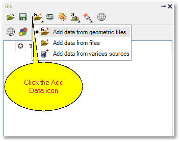
•Click the ![]() Add Data icon and then select the Add data from geometric files pop-up menu item:
Add Data icon and then select the Add data from geometric files pop-up menu item:
•From the ensuing file dialog box, browse to the ...\Documents\GLS\Albion\Advanced_Printing_Excercise folder and then select the Region.shp and AreaOfInterest.shp shapefiles to open. (The files can be selected at once by multi-selecting, via e.g. CTRL + Left-click). Note that the GIS Layer Manager box now contains the Region.shp and AreaOfInterest.shp GIS layers.
•Also from the above file dialog box, load Data.sqlite and from the Load Tables box select PriorityAreas:
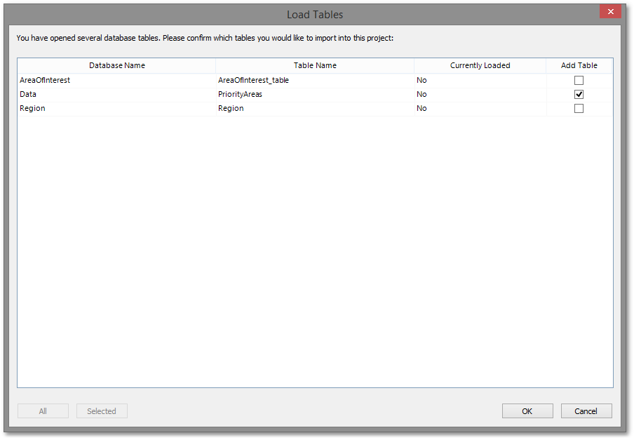
SQLite files are compact single file databases that can contain one or many tables with or without geometry. Note that the GIS Layer Manager box now also contains the Data: PriorityAreas layer.
When loaded successfully, the screen should look like this:
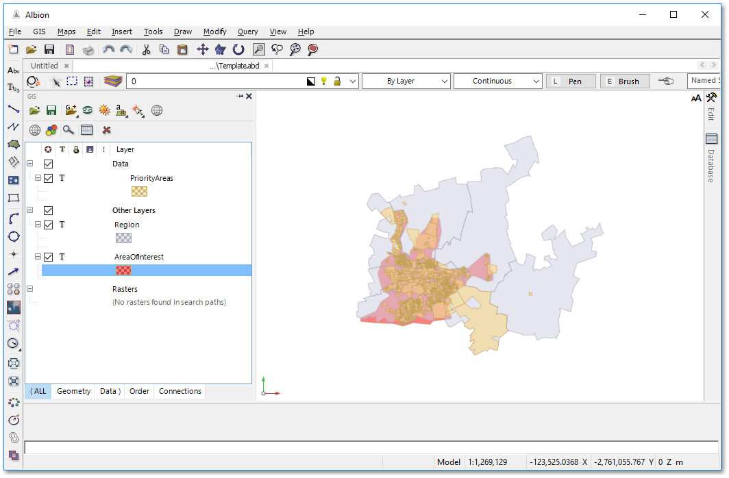
Also note, that your AreaofInterest layer may have a different colour than the red shown above. In the next section we will demonstrate how to change the layer display (i.e. setting styles and rendering).