The Model Data > Model Export > Export Link Layers function has options to export all system links. The Export Links box will appear from which system and result fields can be selected that should appear in the final GIS layer data (attribute) table:
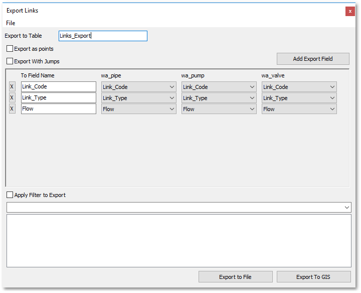
The user can select fields from the Pipe & CV, Pump and Valve Tables. The fields can be selected from the corresponding drop-down list boxes and will then automatically appear in the To Field Name input box. The Add Export Field button can be clicked to add a new export field (i.e. a new row will be added to the Export Links table wizard). The output (i.e. export) GIS layer data name can be specified at the Export to Table input box. This exported table will contain all the link information, i.e. merged into one table.
The Export With Jumps tick box can be checked to include jumps (i.e. to draw small half circles where link crossings occur) in the exported shapefile (when the Export to File button is clicked). Export to File exports the shapefile (with all links and information merged into one shapefile). When the Export to GIS button is clicked, then only the data (i.e. attribute) table of the aforementioned merged export GIS layer will appear in the GIS Layer Manager flagged with a star on which the user can click to save it.
Note, a filter can be applied (by entering an SQL query expression) to export only specific links.