The land use layer data can be edited by opening the table (via the ![]() Database icon as described for viewing layer data), then simply double-clicking on the field values and overwrite them. Albion also has a very useful interactive editing capability between the spatial and table environments, which will be demonstrated here below:
Database icon as described for viewing layer data), then simply double-clicking on the field values and overwrite them. Albion also has a very useful interactive editing capability between the spatial and table environments, which will be demonstrated here below:
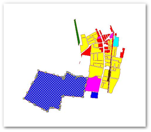
•Click somewhere on the perimeter of the big blue polygon (in the south) - it is now spatially selected as shown below:
•Open the layer data table by clicking on the ![]() Database icon (as described for viewing layer data). The associated record of the spatially selected polygon will now automatically also become selected and highlighted in the table:
Database icon (as described for viewing layer data). The associated record of the spatially selected polygon will now automatically also become selected and highlighted in the table:
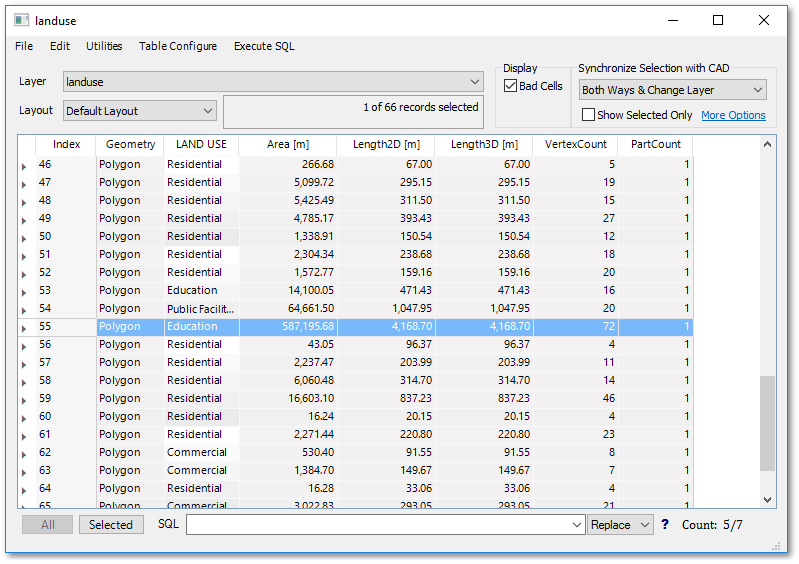
•In the selected row, double-click on the "Education" text (of the LAND_USE field). Overwrite it with the text "Commercial" as shown below (then press Enter, to update the table):
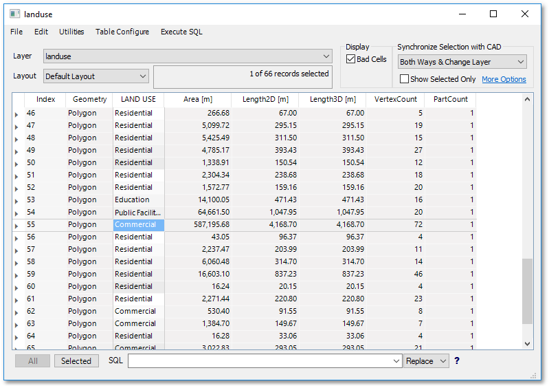
•Notice how the polygon colour will automatically change to red, which is the colour associated with commercial property (see rendering shapefiles).
•Also try out the following: Select any other record in the table by clicking anywhere on that row. You will see that the associated polygon shape becomes selected in the spatial environment as well...