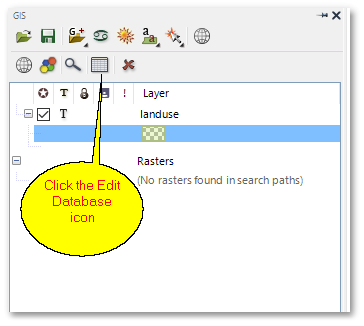
Information associated with the land use polygons, such as e.g. the land use type, area and perimeter are stored in a database table which can be opened and viewed as follows:
•Click the ![]() Edit Database icon:
Edit Database icon:
•The following layer data table (i.e. the landuse shapefile layer data table) will appear:
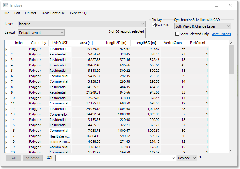
We will only view the table (also referred to as table grid) at this stage. Note that each row in the table is linked to a land use polygon shape.
You can also click (i.e. select) a polygon shape in the spatial environment and then click the ![]() Edit Database icon on the Edit Properties Bar, to view (in the Edit box) the database properties for the selected shape.
Edit Database icon on the Edit Properties Bar, to view (in the Edit box) the database properties for the selected shape.